Participatory Mapping
Overview
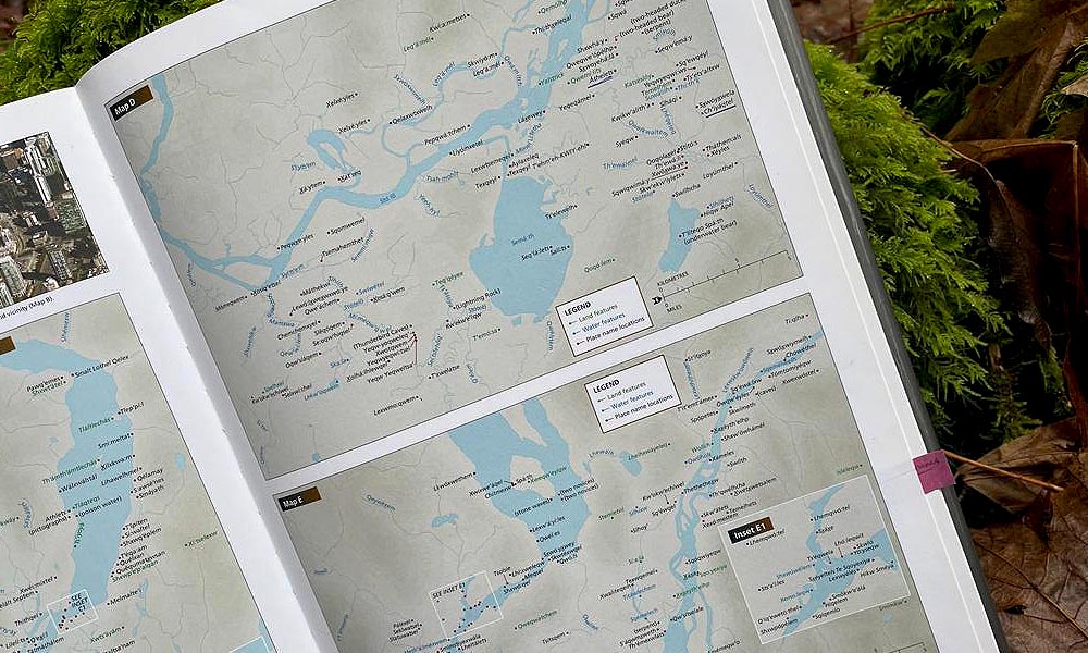
Participatory mapping is a mapping process with community members that helps to make visible the association between land and local communities, at times incorporating local languages and stories. Counter-mapping is a related practice in that it resists colonial maps and supports alternative means of place-making and land-based knowledge sharing.
Example
In The Last of the Shor Shamans, Alexander Arbachakov and Luba Arbachakov discuss maps with Indigenous Elders to trace existing and historic hunting grounds, sacred places, and animal migration routes, as well as the locations of rare and endangered plants and animals.
Literature
- Arbachakov, A., & Arbachakov, L. (2008). The last of the Shor Shamans. John Hunt Publishing.
- Eades, G. L. (2015). Maps and memes: Redrawing culture, place, and identity in Indigenous communities (Vol. 76). McGill-Queen’s Press-MQUP.
- Sletto, B. (2012). Indigenous rights, insurgent cartographies, and the promise of participatory mapping. Portal, Issue 7, 2012.
- Thapa, K., & Thompson, S. (2020). Applying Density and Hotspot Analysis for Indigenous Traditional Land Use: Counter-Mapping with Wasagamack First Nation, Manitoba, Canada. Journal of Geoscience and Environment Protection, 8(10), 285-313.
- Etongo, D. B., & Glover, E. K. (2012). Participatory resource mapping for livelihood values derived from the forest in Ekondo-Titi subregion, Cameroon: a gender analysis. International Journal of Forestry Research, 2012.
- Kalibo, H. W., & Medley, K. E. (2007). Participatory resource mapping for adaptive collaborative management at Mt. Kasigau, Kenya. Landscape and Urban Planning, 82(3), 145-158.
Overview
Land use and occupancy mapping is a form of participatory mapping where Indigenous communities map and describe their own traditional and contemporary areas of land use. Through these mapping processes, communities can mobilize this information when in dialogue or negotiation with other communities or nations.
Examples
- Arctic Seas (www.arcticseas.org) is a network of local and Indigenous communities around the north. The Arctic Seas map conveys how the Indigenous and local communities in this region self-conceptualize their home worlds and marine coasts.
- Geographical Information Systems or GIS, are a common tool when visualizing, storing, or analyzing geographic information. Two common GIS programs are ArcGIS and QGIS (Open-Source). There are ongoing efforts to expand on the capacity of GIS to mobilize qualitative data, efforts which would allow for GIS practices which are more inclusive of knowledge and knowledge systems which occur outside of the western scientific tradition. One example of these efforts can be found in this interactive story map (https://www.ntkp.ca/), created by the Kitikmeot Inuit Association (KitIA) in collaboration with industry and academic partners. Mapping efforts like these allow for the storage of a diverse breadth of knowledge forms (spoken, written, drawn), and have the potential to be edited and added to over time.
- More resources and information can be found on the Aboriginal Mapping Network (http://nativemaps.org/) website.
Literature
- Hemming, S., & Rigney, D. (2012). 11 Indigenous Land Use and Occupancy Mapping as a Technology of Power. Information Technology, Development, and Social Change, 32, 128.
- Joly, T. L., Longley, H., Wells, C., & Gerbrandt, J. (2018). Ethnographic refusal in traditional land use mapping: Consultation, impact assessment, and sovereignty in the Athabasca oil sands region. The Extractive Industries and Society, 5(2), 335-343.
- McIlwraith, T., & Cormier, R. (2015). Making Place for Space: Site-specific Land Use and Occupancy Studies in the Context of the Supreme Court of Canada’s Tsilhqot’in Decision. BC Studies: The British Columbian Quarterly, (188), 35-53.
- Norwegian, G. C. H., & Cizek, P. (2004). Using Land Use and Occupancy Mapping and GIS to Establish a Protected Area Network in the Deh Cho Territory. URL: www. dehchofirstnations. com/documents/press/04_03_22_land_use_paper_norwe gian_and_cizek. pdf.
- Olson, R., Hackett, J., & DeRoy, S. (2016). Mapping the digital terrain: towards indigenous geographic information and spatial data quality indicators for indigenous knowledge and traditional land-use data collection. The Cartographic Journal, 53(4), 348-355.
- Tobias, T. N. (2000). Chief Kerry’s moose: a guidebook to land use and occupancy mapping, research design, and data collection.
Learn from our Team! Watch the recorded session titled ‘Tools for Cultural Mapping in Research,’ which took place on January 22, 2024. This two-hour session brings together a diverse panel from around the world, each offering distinct perspectives on utilizing cultural mapping as a method for documenting and preserving Indigenous knowledge, biodiversity research, and more.
Presenters:
Sharon Snowshoe (ILPBP Co-Applicant), Alestine Andre, and Kristi Benson – Gwich’in Tribal Council
Dave Schaepe – Director & Senior Archaeologist of the Stó:lō Research and Resource Management Centre
Peter Pulsifer – Specialist in geomatics and cartography at Carleton University
Sharlene Alook – Bigstone Cree First Nation, Ărramăt Team Member, UAlberta Graduate Student
¡Haga clic aquí para verlo en español!

